Montrose to Inverie
By Willie Gibson

It was while I was on the club trip to Norway 2 years ago that
I thought that a similar thing would be possible in Scotland. Last year on Holiday
in the 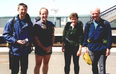 summer I was in the caravan at St Cyrus and thinking of long routes
in Scotland. I got out the Scotland map and saw that there seemed to be an almost
unbroken band of Hills between Stonehaven and Knoydart. Having never been to
Knoydart I thought what better way to get there than on foot from Montrose!
I Emailed the Usual Suspects with my "NEW" idea, by return from Nigel
I received a message telling me of his idea thought up in nineteen oatcake of
Montrose to Mallaig, he sent me an excel sheet with it all measured out! The
Brian Cunningham sent me a book he had written about his Stonehaven to Knoydart
trip! Then Dave Peck sent me a book describing a similar route in reverse and
Colin Pritchard gave me "Across Scotland on Foot". I suppose that
a good idea is seldom new! Or perhaps I am not the only idiot in the Club!
summer I was in the caravan at St Cyrus and thinking of long routes
in Scotland. I got out the Scotland map and saw that there seemed to be an almost
unbroken band of Hills between Stonehaven and Knoydart. Having never been to
Knoydart I thought what better way to get there than on foot from Montrose!
I Emailed the Usual Suspects with my "NEW" idea, by return from Nigel
I received a message telling me of his idea thought up in nineteen oatcake of
Montrose to Mallaig, he sent me an excel sheet with it all measured out! The
Brian Cunningham sent me a book he had written about his Stonehaven to Knoydart
trip! Then Dave Peck sent me a book describing a similar route in reverse and
Colin Pritchard gave me "Across Scotland on Foot". I suppose that
a good idea is seldom new! Or perhaps I am not the only idiot in the Club!
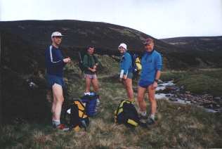
We had around 8 people signed up at first but in the end it was Nigel Rose, Jim McWhinnie, Moira Stewart and I that set off on the train to Montrose on Saturday 3rd June. We got off the train in Montrose to waves from Nick and Irene Schierloh, they proceeded to rob us of as much heavy gear as the could and took it off to our first stop. We headed east to the beach stopping at the seafront café for a hamburger and chips to prepare us for the toils to come!
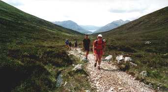
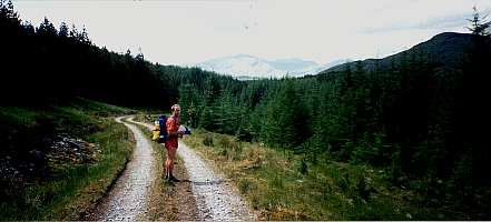
Day 1 Montrose to Edzell, 15 miles. 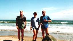
We paddled in the sea and took the compulsory photographs, then headed north
along the beach to the mouth of the Esk and then headed by minor road towards
Edzell. It was a hot sunny day and the tarmac was hard, but the roads were quiet.
We were soon thankful for the lack of heavy packs, but the day was wonderful.
It was a punishing run, especially when we passed a turnip lying in the road
and I picked it up and said that I should take it to the Library! Moira (quick
as a flash) said a "Turnip for the Books!" , she knows my sense of
humour! We passed a caravan site after about 10 miles and saw an Ice Cream sign,
what a relief! Soon after Nick and Irene  passed in the
car saying that they had found our B & B and left the Stuff. We were fed
up of the Tarmac by this time and headed through a dairy farm to the banks of
the Esk and fought through nettles to Edzell. Accommodation around Edzell had
been the hardest to organise. Nick and Irene had done some phoning around, but
Joanne Anderson had an Aunt in Glen Esk. She spent ages contacting people for
us, and gave me the number
passed in the
car saying that they had found our B & B and left the Stuff. We were fed
up of the Tarmac by this time and headed through a dairy farm to the banks of
the Esk and fought through nettles to Edzell. Accommodation around Edzell had
been the hardest to organise. Nick and Irene had done some phoning around, but
Joanne Anderson had an Aunt in Glen Esk. She spent ages contacting people for
us, and gave me the number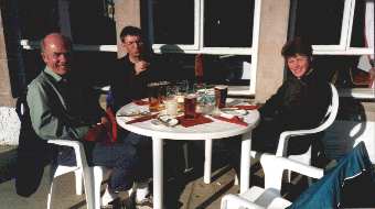 of a Betty Macdonald,
who had a family room. She couldn't come to terms with the fact that we would
all stay in the one room and were happy to sleep on the floor, she offered us
a discount! Thanks Auntie Gladys! We showered and ate in the local Hotel, had
a visit from the Schierlohs and a good night sleep before a very heavy metal
breakfast.
of a Betty Macdonald,
who had a family room. She couldn't come to terms with the fact that we would
all stay in the one room and were happy to sleep on the floor, she offered us
a discount! Thanks Auntie Gladys! We showered and ate in the local Hotel, had
a visit from the Schierlohs and a good night sleep before a very heavy metal
breakfast.
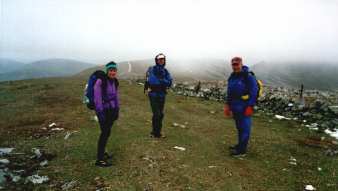
Day 2 Edzell to Glen Doll, 26 miles.
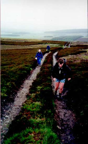
 We were off of the road within a mile
and at least heading for the hills. Cloud and rain had replaced the clear skies
of the day before. We were expecting poor terrain, but in fact there was a good
fence line most of the way. The weather wasn't too bad and the hills were lovely,
seldom visited by walkers and good rounded ridges. There was the odd peat hag
to sort us out, and a lot of undulation. We weren't really aware of the weather
getting colder, but as we reached the highest point in the mist and rain we
notice white stuff stuck to the summit cairn! It was snowing!! We hit a good
track and started running towards Loch Brandy, we realised that we were too
cold to stop and get more clothes on so made a hasty exit off into Glen Clova
before hypothermia set in! It didn't seem to matter that our navigation had
left us about half a mile too far south, we were happy to be off of the Tops.
On the way down the track
We were off of the road within a mile
and at least heading for the hills. Cloud and rain had replaced the clear skies
of the day before. We were expecting poor terrain, but in fact there was a good
fence line most of the way. The weather wasn't too bad and the hills were lovely,
seldom visited by walkers and good rounded ridges. There was the odd peat hag
to sort us out, and a lot of undulation. We weren't really aware of the weather
getting colder, but as we reached the highest point in the mist and rain we
notice white stuff stuck to the summit cairn! It was snowing!! We hit a good
track and started running towards Loch Brandy, we realised that we were too
cold to stop and get more clothes on so made a hasty exit off into Glen Clova
before hypothermia set in! It didn't seem to matter that our navigation had
left us about half a mile too far south, we were happy to be off of the Tops.
On the way down the track we met a runner coming up, after inquiring where we were going and was told
"Knoydart", his reply was "It Must Be Carnethy!". The road
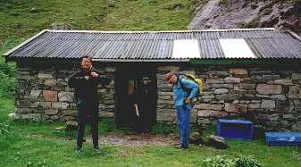
to Glen Doll was hard, but warmer. The hostel was a welcome sight! Hostels have
changed recently!, when I had phoned asking if they had a shop, the warden had
said she would buy us in some shopping! I gave her the order, Rolls, bacon,
bread, eggs, Pasta , sauce and BEER! What service! After a good meal and a good
sleep and a heavy metal breakfast we were off again!
we met a runner coming up, after inquiring where we were going and was told
"Knoydart", his reply was "It Must Be Carnethy!". The road
to Glen Doll was hard, but warmer. The hostel was a welcome sight! Hostels have
changed recently!, when I had phoned asking if they had a shop, the warden had
said she would buy us in some shopping! I gave her the order, Rolls, bacon,
bread, eggs, Pasta , sauce and BEER! What service! After a good meal and a good
sleep and a heavy metal breakfast we were off again!
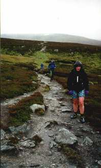
Day3 Glen Doll to Spittal of Glenshee, 19 miles
 It wasn't a nice day! That was no surprise after yesterday, but optimistic
as ever we headed for the tops, but today Moira and I had put the shorts away
and were wearing our winter gear! We climbed through the forest on the path
after crossing the bridge that wasn't on Nigel's old map, and headed
It wasn't a nice day! That was no surprise after yesterday, but optimistic
as ever we headed for the tops, but today Moira and I had put the shorts away
and were wearing our winter gear! We climbed through the forest on the path
after crossing the bridge that wasn't on Nigel's old map, and headed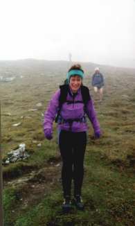 into the mist of Dreish.
Then across to Mayar, the views of the mist were tremendous, so good that we
thought that it was worth taking in a few more Munros. Jim's navigation day
still fresh in our minds we headed across the moor towards Tom Buidhe, crossing
new snow and found the summit and then on to Carn of Claise, More snow and it
was hard to keep to the path. We neared the summit and came upon a wall, after
a discussion we turned in the right direction and found the summit cairn. Then
it was on to Glas Maol. This was fairly straightforward but after arguing about
a path split we found that both paths met each other another 50 metres on! On
the way up to the summit we saw a peculiar sight! A lobster pot, I kid you not,
sitting on the hillside! We speculated on the Glenshee lobster, bred specially
for its meaty Legs! We ran off of towards Creag
into the mist of Dreish.
Then across to Mayar, the views of the mist were tremendous, so good that we
thought that it was worth taking in a few more Munros. Jim's navigation day
still fresh in our minds we headed across the moor towards Tom Buidhe, crossing
new snow and found the summit and then on to Carn of Claise, More snow and it
was hard to keep to the path. We neared the summit and came upon a wall, after
a discussion we turned in the right direction and found the summit cairn. Then
it was on to Glas Maol. This was fairly straightforward but after arguing about
a path split we found that both paths met each other another 50 metres on! On
the way up to the summit we saw a peculiar sight! A lobster pot, I kid you not,
sitting on the hillside! We speculated on the Glenshee lobster, bred specially
for its meaty Legs! We ran off of towards Creag 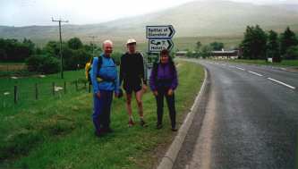 Leacach and dropped out of the mist
for the first time that day. The views down the ridge to Spittal were stunning
and after the sixth Munro of the day it was nice to be heading down on good
running. Halfway down the ridge we met Bill, who had run up to meet us from
Spittal, we had a brief chat , arranged to meet him at the Hotel, and headed
on down leaving him to bag a couple of Hills. We had the bunkroom to ourselves,
and showered and pinted and then headed to the restaurant where we had the best
meal of the holiday! The main course was a choice of, Salmon, Haggis, ratatouille,
stovies, sausages and gravy, roast beef OR all of it! We had all of it! The
rest of the evening was spent listening to the amazing entertainment, alongside
two busloads of Cottontops (a McWhinnie name for senior citizens). The mixture
of sing something simple and Elvis was incredible. The next morning we couldn't
do justice to the breakfast after the excesses of the previous night but tried
hard anyway!
Leacach and dropped out of the mist
for the first time that day. The views down the ridge to Spittal were stunning
and after the sixth Munro of the day it was nice to be heading down on good
running. Halfway down the ridge we met Bill, who had run up to meet us from
Spittal, we had a brief chat , arranged to meet him at the Hotel, and headed
on down leaving him to bag a couple of Hills. We had the bunkroom to ourselves,
and showered and pinted and then headed to the restaurant where we had the best
meal of the holiday! The main course was a choice of, Salmon, Haggis, ratatouille,
stovies, sausages and gravy, roast beef OR all of it! We had all of it! The
rest of the evening was spent listening to the amazing entertainment, alongside
two busloads of Cottontops (a McWhinnie name for senior citizens). The mixture
of sing something simple and Elvis was incredible. The next morning we couldn't
do justice to the breakfast after the excesses of the previous night but tried
hard anyway!
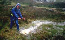
Day 4 Spittal to Tarf, 16 miles.
 Jim was depressed! He had left this
map
Jim was depressed! He had left this
map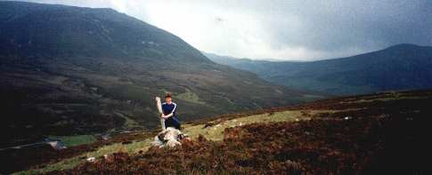 behind,
it was a day for relying on other. We headed up the Road to The Dalmunzie Hotel
and then up Glen Lochsie along the old railway, towards Glas Tuilaichean, again
climbing into the mist as we headed for the summit. We dropped out the mist
coming off the other side and decided to go up Carn an Righ, this was a good
runnable track until we started climbing again. Once more into the mist! At
the top we said goodbye to Bill as he headed back for a badminton appointment
that evening. We headed Northwest to Fealar lodge, dropping off of the ridge
about 1K earlier that we had thought, but could see the lodge in the distance
as we came out of the cloud and into better weather! It was a good run across
bog to reach the path to the Lodge (20 miles by track from any road), and a
good run down to the Lodge. The path down to the Tilt from the lodge is spectacular
with
behind,
it was a day for relying on other. We headed up the Road to The Dalmunzie Hotel
and then up Glen Lochsie along the old railway, towards Glas Tuilaichean, again
climbing into the mist as we headed for the summit. We dropped out the mist
coming off the other side and decided to go up Carn an Righ, this was a good
runnable track until we started climbing again. Once more into the mist! At
the top we said goodbye to Bill as he headed back for a badminton appointment
that evening. We headed Northwest to Fealar lodge, dropping off of the ridge
about 1K earlier that we had thought, but could see the lodge in the distance
as we came out of the cloud and into better weather! It was a good run across
bog to reach the path to the Lodge (20 miles by track from any road), and a
good run down to the Lodge. The path down to the Tilt from the lodge is spectacular
with 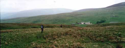 steep
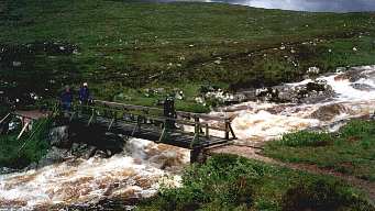
sided gorges and waterfalls, we ran down to the suspension bridge over the Tarf,
where a group of about 20 squadies were hard at rest not repairing the bridge.
Then we headed upstream
steep
sided gorges and waterfalls, we ran down to the suspension bridge over the Tarf,
where a group of about 20 squadies were hard at rest not repairing the bridge.
Then we headed upstream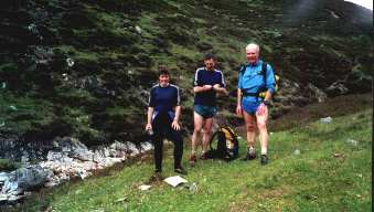 through thick heather and itermittant paths looking down on the
wonderful views of the falls of Tarf. We took hours to get to the calmer waters
of the upper Tarf and headed upstream to the Bothy known as The Tarf Hotel,
in itermittant showers. The Bothy is on a wonderful setting at the meeting of
two streams and has 3 rooms each with a fire. It had been a hard day.
through thick heather and itermittant paths looking down on the
wonderful views of the falls of Tarf. We took hours to get to the calmer waters
of the upper Tarf and headed upstream to the Bothy known as The Tarf Hotel,
in itermittant showers. The Bothy is on a wonderful setting at the meeting of
two streams and has 3 rooms each with a fire. It had been a hard day.  We hung our wet gear in the drying
area I pitched my tent then cooked a meal and poured a whisky. It was nice to
We hung our wet gear in the drying
area I pitched my tent then cooked a meal and poured a whisky. It was nice to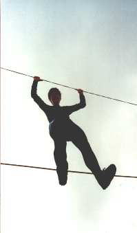 have the Bothy to ourselves! There was a noise outside, the door opened and
Jim looked up and said "hello" to the guy that walked in, then he
said HELLO as it was Gary MacInnes, who had decided to head in to join us for
the night! He and his bottle of Jameson's were welcome additions to our first
Bothy Night, which started with a nip by the fire, and degenerated somewhat,
ending when Nigel thought that the grass outside was moving too much, and Gary
had to hold on to his chair as he stood up just in case it slipped off of the
floor!
have the Bothy to ourselves! There was a noise outside, the door opened and
Jim looked up and said "hello" to the guy that walked in, then he
said HELLO as it was Gary MacInnes, who had decided to head in to join us for
the night! He and his bottle of Jameson's were welcome additions to our first
Bothy Night, which started with a nip by the fire, and degenerated somewhat,
ending when Nigel thought that the grass outside was moving too much, and Gary
had to hold on to his chair as he stood up just in case it slipped off of the
floor! 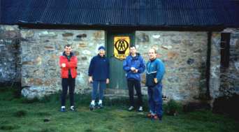
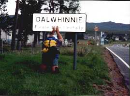
Day5 Tarf to Dalwhinnie 25miles,
 The weather was looking good as we headed north to Carn an Fhidlair,
the walk up the river was pleasant and the clear skies helped clear our heads!
The views were getting better every step as we climbed to the summit and I was
at the smiley happy man in the wilderness stage as we said goodbye to Gary at
the top. He headed of to An Sgarsoch and back home. We headed east across pathless
heather towards Gaick Lodge. The hills here are wild, but rounded, some good
running through dry peat hags, some easy sinking in wet peat hags. We headed
for a Lochan that had been stolen (well it wasn't where it should have been),
The weather was looking good as we headed north to Carn an Fhidlair,
the walk up the river was pleasant and the clear skies helped clear our heads!
The views were getting better every step as we climbed to the summit and I was
at the smiley happy man in the wilderness stage as we said goodbye to Gary at
the top. He headed of to An Sgarsoch and back home. We headed east across pathless
heather towards Gaick Lodge. The hills here are wild, but rounded, some good
running through dry peat hags, some easy sinking in wet peat hags. We headed
for a Lochan that had been stolen (well it wasn't where it should have been),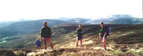 and then on to another which had gone the same way. It must have
been a dry spring!. Jim was getting excited at this stage, as he was about to
reach the edge of his Map. I was depressed, I had forgotten the next map! The
stunning ravine down towards Gaick was awesome, it opened into a flat steep
sided valley as we ran the couple of miles to the Lodge. Looking up to the Dalwhinnie
hills, the excellent stalkers
and then on to another which had gone the same way. It must have
been a dry spring!. Jim was getting excited at this stage, as he was about to
reach the edge of his Map. I was depressed, I had forgotten the next map! The
stunning ravine down towards Gaick was awesome, it opened into a flat steep
sided valley as we ran the couple of miles to the Lodge. Looking up to the Dalwhinnie
hills, the excellent stalkers 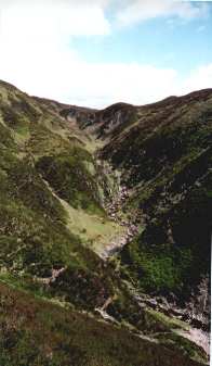 track zigzagging
up the hill looked like hard work! It was, but the reward of the views was worth
the pain! We crossed the plateau at the top and dropped down to the track along
side the aqueduct to Dalwhinnie, and ran the five miles of hell to the Ben Alder
restaurant where Janet was waiting. We sat having
track zigzagging
up the hill looked like hard work! It was, but the reward of the views was worth
the pain! We crossed the plateau at the top and dropped down to the track along
side the aqueduct to Dalwhinnie, and ran the five miles of hell to the Ben Alder
restaurant where Janet was waiting. We sat having 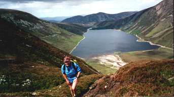 a beer and the waitress told us that
although we were booked in, the bunkhouse was full and we would have to stay
in the Loch Ericht Hotel instead for the same price. Damn!!!!! We had a fine
meal, I was given an extra pudding as I had looked hungry! And a good evening,
Janet enjoying the riveting conversation, well the snoring anyway. It had been
a hard day!
a beer and the waitress told us that
although we were booked in, the bunkhouse was full and we would have to stay
in the Loch Ericht Hotel instead for the same price. Damn!!!!! We had a fine
meal, I was given an extra pudding as I had looked hungry! And a good evening,
Janet enjoying the riveting conversation, well the snoring anyway. It had been
a hard day!
Day 6 Dalwhinnie to Tulloch 27 miles
 The night in the hotel had been restful,
and the breakfast at the Ben Alder restaurant had been fulfilling. As we were
packing up to leave Nigel bent over by the whisky display cabinet and as he
stood up , his head and the cabinet met! Luckily the local nurse (Mrs McWhinnie)
was on hand to stick a large plaster on his head. That is of course after shaving
all the hair away!!!! Nigel was plastered again as we headed for Lock Ericht.
The track is a bit of a plod, but well finished and passes some interesting
new buildings in the "I have just built a Scottish Castle" style.
It was beginning to rain hard as we reached the stable just before Loch Pattack.
We sheltered had a bite to eat
The night in the hotel had been restful,
and the breakfast at the Ben Alder restaurant had been fulfilling. As we were
packing up to leave Nigel bent over by the whisky display cabinet and as he
stood up , his head and the cabinet met! Luckily the local nurse (Mrs McWhinnie)
was on hand to stick a large plaster on his head. That is of course after shaving
all the hair away!!!! Nigel was plastered again as we headed for Lock Ericht.
The track is a bit of a plod, but well finished and passes some interesting
new buildings in the "I have just built a Scottish Castle" style.
It was beginning to rain hard as we reached the stable just before Loch Pattack.
We sheltered had a bite to eat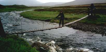 and started for Culra through the
rain. The shelter of Culra was welcomed but after a 20 minute rest we braved
the elements and headed for the Bealach Dhu , having given up on the high level
option due tot he conditions. The run up to the Bealach was exciting with the
rivers getting wilder and wilder and the tributary crossings becoming more and
more treacherous. Fountains were appearing by the side of the path. We reached
the top of the pass and ran down the other side, deciding to cross the river
fairly high up us it was looking rather rapid. After much too-ing and fro-ing
we got across and headed down towards Ossian. As we passed the plaque for Peter
and started for Culra through the
rain. The shelter of Culra was welcomed but after a 20 minute rest we braved
the elements and headed for the Bealach Dhu , having given up on the high level
option due tot he conditions. The run up to the Bealach was exciting with the
rivers getting wilder and wilder and the tributary crossings becoming more and
more treacherous. Fountains were appearing by the side of the path. We reached
the top of the pass and ran down the other side, deciding to cross the river
fairly high up us it was looking rather rapid. After much too-ing and fro-ing
we got across and headed down towards Ossian. As we passed the plaque for Peter
 Brooks,
Moira twisted her already sore ankle, and started to hobble. She womanfully
carried on down to the bridge at Ossian where we decided to send Nigel and Jim
ahead to Tulloch to warn Janet that we would be late as Moi had to walk out.
Moira and I aimed for the
Brooks,
Moira twisted her already sore ankle, and started to hobble. She womanfully
carried on down to the bridge at Ossian where we decided to send Nigel and Jim
ahead to Tulloch to warn Janet that we would be late as Moi had to walk out.
Moira and I aimed for the 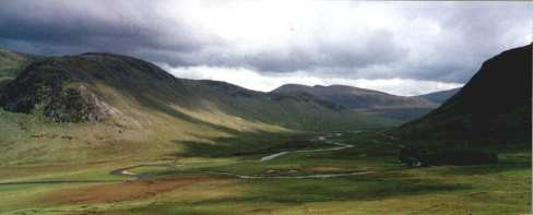 landrover
track to make the going easier. We stopped, Moira popped a few Ibuprofen and
I wound my elastic bandage round her ankle and we started walking. After half
a mile Moira said she thought she could run so we headed off at a jog! We reached
the house at Strath Ossian and saw Nigel and Jim about 100 metres ahead! They
had had an interesting river crossing that will no doubt be recounted in another
article. I was going to shout on them but decided that we may still hold them
up so we walked behind them for about 3 miles. Eventually they
landrover
track to make the going easier. We stopped, Moira popped a few Ibuprofen and
I wound my elastic bandage round her ankle and we started walking. After half
a mile Moira said she thought she could run so we headed off at a jog! We reached
the house at Strath Ossian and saw Nigel and Jim about 100 metres ahead! They
had had an interesting river crossing that will no doubt be recounted in another
article. I was going to shout on them but decided that we may still hold them
up so we walked behind them for about 3 miles. Eventually they 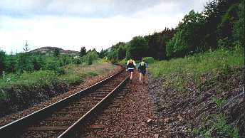 looked
aback and we caught them up. Moira managed to run most of the way to Fersit.
We followed the path marked on the map down the side of the railway, it disappeared
and we found ourselves walking up the railway to the Station at Tulloch, and
waving slightly embarrassed to the driver of the train that was waiting there!
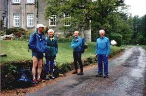
The station bunkhouse was wonderful and we had good food and met Janet McWhinnie
and Nick Macdonald. Moira was given a cool bag full of Ice that she wore as
a shoe for the rest of the night.
looked
aback and we caught them up. Moira managed to run most of the way to Fersit.
We followed the path marked on the map down the side of the railway, it disappeared
and we found ourselves walking up the railway to the Station at Tulloch, and
waving slightly embarrassed to the driver of the train that was waiting there!
The station bunkhouse was wonderful and we had good food and met Janet McWhinnie
and Nick Macdonald. Moira was given a cool bag full of Ice that she wore as
a shoe for the rest of the night.
Day 7 Tulloch to Tomdoun, 28 miles
 The six of us had a hearty breakfast, I strapped up Moira's ankle
and we headed off towards Glen Roy. We decided, as was becoming customary, to
miss out the Munro on the route due to the distance that we had to travel that
day! We actually blamed Moira's ankle so as not to lose face! The views back
to Loch Treig were spectacular as we climbed above the forest to the Bealach
and as we dropped into Glen Roy the river cascading over waterfalls was wonderful.
There was the odd squeal from Moi every now and then as we ran down the track
and viewed
The six of us had a hearty breakfast, I strapped up Moira's ankle
and we headed off towards Glen Roy. We decided, as was becoming customary, to
miss out the Munro on the route due to the distance that we had to travel that
day! We actually blamed Moira's ankle so as not to lose face! The views back
to Loch Treig were spectacular as we climbed above the forest to the Bealach
and as we dropped into Glen Roy the river cascading over waterfalls was wonderful.
There was the odd squeal from Moi every now and then as we ran down the track
and viewed 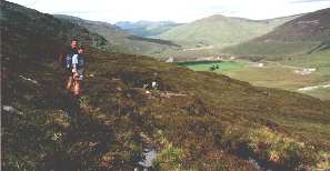 the parallel roads that make the Glen
famous (they are in fact raised beaches from a glacial lake). The weather was
glorious as we sunbathed for a while over what was meant to be a snack but turned
into an early lunch. The climb out of the glen was hard and we headed west to
try to find a route to Laggan Locks. There was a forest blocking our way and
the map gave no hint of the best place to cross. After much argument we headed
down and found a zigzag route by track through the pines. Nigel commenting that
he preferred the direct approach! We sat by the locks while Nick phoned
the parallel roads that make the Glen
famous (they are in fact raised beaches from a glacial lake). The weather was
glorious as we sunbathed for a while over what was meant to be a snack but turned
into an early lunch. The climb out of the glen was hard and we headed west to
try to find a route to Laggan Locks. There was a forest blocking our way and
the map gave no hint of the best place to cross. After much argument we headed
down and found a zigzag route by track through the pines. Nigel commenting that
he preferred the direct approach! We sat by the locks while Nick phoned  Dave for some directions!, upset that we still had miles to go but
the Great Glen was a milestone! We fought through Bracken up the hill west of
the glen and then had about a couple of miles of tundra till we entered the
forest and started running through the never ending tracks towards Garry Bridge.
Jim and Janet had decided to take it easy and were happy being left behind,
Dave for some directions!, upset that we still had miles to go but
the Great Glen was a milestone! We fought through Bracken up the hill west of
the glen and then had about a couple of miles of tundra till we entered the
forest and started running through the never ending tracks towards Garry Bridge.
Jim and Janet had decided to take it easy and were happy being left behind,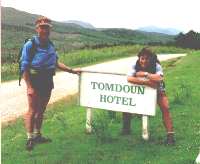 Nick stopped for a mars bar and was
unhappy at being left behind. Nigel, Moi and I crossed the bridge and turned
left towards Tomdoun, Nick ate the mars bar struggled with his zip, took ages
and reached the T junction not knowing which way to go. We kept looking back
but couldn't see him. Eventually we got to the hotel and 10 minutes later a
pissed off Nick appeared, bottom lip quivering, but the pint I had bought him
sorted him out. Jim and Janet were about 20 minutes behind! The accommodation
was basic, in sheds out the back, but Jim and I pitched tents and we had a good
meal, and next morning we had a hearty breakfast.
Nick stopped for a mars bar and was
unhappy at being left behind. Nigel, Moi and I crossed the bridge and turned
left towards Tomdoun, Nick ate the mars bar struggled with his zip, took ages
and reached the T junction not knowing which way to go. We kept looking back
but couldn't see him. Eventually we got to the hotel and 10 minutes later a
pissed off Nick appeared, bottom lip quivering, but the pint I had bought him
sorted him out. Jim and Janet were about 20 minutes behind! The accommodation
was basic, in sheds out the back, but Jim and I pitched tents and we had a good
meal, and next morning we had a hearty breakfast.
Day 8 Tomdoun to Sourlies, 22 miles
 The day started with sunshine as we ambled down the road and crossed
the bridge and headed for Glen Kingy.
The day started with sunshine as we ambled down the road and crossed
the bridge and headed for Glen Kingy.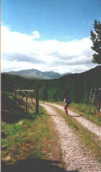 The views of the Knoydart hills
were tremendous and the going was slow due to the need to take in the weather
and the views. As we broke through the forest we could see the a Munro ahead.
The path seemed to lead up it. I was unable to miss it out. Jim Janet and Nigel
decided to head for Glen Dessary and the low level but beautiful route to the
Bothy. Moira, Nick and I headed up. It was a hard climb to the top of Sgurr
Mor, but the views made it worth the pain. We watched the clouds gathering and
the rain started as we headed along the undulating ridge towards Glen Dessary.
The descent was difficult and the going was very wet
The views of the Knoydart hills
were tremendous and the going was slow due to the need to take in the weather
and the views. As we broke through the forest we could see the a Munro ahead.
The path seemed to lead up it. I was unable to miss it out. Jim Janet and Nigel
decided to head for Glen Dessary and the low level but beautiful route to the
Bothy. Moira, Nick and I headed up. It was a hard climb to the top of Sgurr
Mor, but the views made it worth the pain. We watched the clouds gathering and
the rain started as we headed along the undulating ridge towards Glen Dessary.
The descent was difficult and the going was very wet 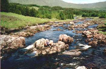 as we reached
the Glen and headed for the Bealach, where Dave had hidden provisions. Dave
Peck had said that he would join us for the weekend, but work commitments wouldn't
allow it. Instead he had run in to within 2 miles of Sourlies and hidden stuff,
including a bottle of malt, what a guy! As we climbed the hill following the
line of boulders we saw a carrier bag ripped and remnants strewn across the
ground,
as we reached
the Glen and headed for the Bealach, where Dave had hidden provisions. Dave
Peck had said that he would join us for the weekend, but work commitments wouldn't
allow it. Instead he had run in to within 2 miles of Sourlies and hidden stuff,
including a bottle of malt, what a guy! As we climbed the hill following the
line of boulders we saw a carrier bag ripped and remnants strewn across the
ground,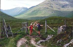 our hearts missed a beat until Nick
put his had behind the rock and pulled out the bottle! We ran off to the bothy
keen to get it opened! We reached the bothy about half an hour behind the others
and 2 hours late, and there were five people already there, I pitched the tent
and got cooking while we had a dram and toasted "That Dave Peck is a wonderful
chap". The cup went round the group getting filled up each time with a
repeated toast. It was now 11:30 and the other bothiers were all in bed. One
of them staggered to his feet and went
our hearts missed a beat until Nick
put his had behind the rock and pulled out the bottle! We ran off to the bothy
keen to get it opened! We reached the bothy about half an hour behind the others
and 2 hours late, and there were five people already there, I pitched the tent
and got cooking while we had a dram and toasted "That Dave Peck is a wonderful
chap". The cup went round the group getting filled up each time with a
repeated toast. It was now 11:30 and the other bothiers were all in bed. One
of them staggered to his feet and went 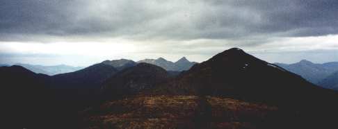 out for a
walk?!
out for a
walk?! At midnight someone asked if the chap had returned? It was a foul night and
he had only gone out in his night attire. We searched for him for 20 minutes
before rousing the rest of the bothy! By 2 a.m. we still had not found him having
tried line searches a round the hut. There was nothing more we could do except
wait for daylight. The door opened and in walked a rather hypothermic bloke
saying, "I saw the light". He had no idea where he had been, Janet
and Moi fed him warm tea and stripped him out of his we clothes. He was put
to bed dry and alive. What a night.! The next morning he was rather thankful
if embarrassed.
At midnight someone asked if the chap had returned? It was a foul night and
he had only gone out in his night attire. We searched for him for 20 minutes
before rousing the rest of the bothy! By 2 a.m. we still had not found him having
tried line searches a round the hut. There was nothing more we could do except
wait for daylight. The door opened and in walked a rather hypothermic bloke
saying, "I saw the light". He had no idea where he had been, Janet
and Moi fed him warm tea and stripped him out of his we clothes. He was put
to bed dry and alive. What a night.! The next morning he was rather thankful
if embarrassed.
Day 9 Sourlies to Inverie 9 miles
 The bothy was quiet as we prepared to leave, all the others had left
already, the day was looking grey but promising. We walked round the coast and
across the flat estuary of the river Carnach. There was a steep climb to the
Col of Mam Meadail following the most incredibly well constructed stalkers path.
There was a drainage ditch built in and the path was a nice dry earth base.
If only the modern paths were so well constructed. At the col there was the
usual huddle. Nigel and I had planned to bag a Munro but the mist was down,
the legs were tired, the pub was calling. It had been a hard week! We decided
just to head down, Nick warned that it would clear and we would be sorry, and
sure enough within 5 minutes the tops were clear! But we were no sorry at all,
we were happy to be enjoying the run down the Glean Meadail. The waterfalls
were spectacular on the way down, and we stopped and nosed about at a bothy
that was being refurbished.
The bothy was quiet as we prepared to leave, all the others had left
already, the day was looking grey but promising. We walked round the coast and
across the flat estuary of the river Carnach. There was a steep climb to the
Col of Mam Meadail following the most incredibly well constructed stalkers path.
There was a drainage ditch built in and the path was a nice dry earth base.
If only the modern paths were so well constructed. At the col there was the
usual huddle. Nigel and I had planned to bag a Munro but the mist was down,
the legs were tired, the pub was calling. It had been a hard week! We decided
just to head down, Nick warned that it would clear and we would be sorry, and
sure enough within 5 minutes the tops were clear! But we were no sorry at all,
we were happy to be enjoying the run down the Glean Meadail. The waterfalls
were spectacular on the way down, and we stopped and nosed about at a bothy
that was being refurbished. It was going
to be wonderful, a note was made of the phone number of the estate then we headed
on to Inverie. The bunkhouse we had booked was a mile from the village on the
route we were going, so we stopped and deposited all our wet gear in the drying
room. Had a shower and a coffee, scrutinised each other for Ticks, booked the
local restaurant for the evening meal and then had a doze. We walked slowly
down to the Village at 6 p.m. Janet's feet having deteriorated so that she had
more blisters than skin. Moira's ankle strapped up,
It was going
to be wonderful, a note was made of the phone number of the estate then we headed
on to Inverie. The bunkhouse we had booked was a mile from the village on the
route we were going, so we stopped and deposited all our wet gear in the drying
room. Had a shower and a coffee, scrutinised each other for Ticks, booked the
local restaurant for the evening meal and then had a doze. We walked slowly
down to the Village at 6 p.m. Janet's feet having deteriorated so that she had
more blisters than skin. Moira's ankle strapped up,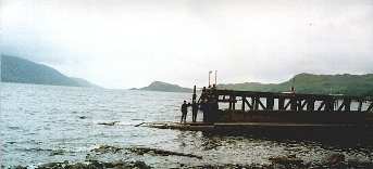 Nigel's head now without its plaster and the rest of us just being knackered.
The sea was reached and we stood on the pier for the "Cross Scotland"
photo and headed for the pub. The meal in the restaurant was great and we all
smiled in an alcoholic fatigued haze reminiscing over the week's tales.
Nigel's head now without its plaster and the rest of us just being knackered.
The sea was reached and we stood on the pier for the "Cross Scotland"
photo and headed for the pub. The meal in the restaurant was great and we all
smiled in an alcoholic fatigued haze reminiscing over the week's tales.
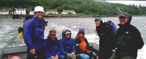
The next morning we got a lift down to the pier from the Bunkhouse owner and got onto our chartered boat and headed for Mallaig and the 10:30 train home. The trip had been an experience (187 miles in 9 days) and as Inverie slowly disappeared from view, we vowed to return to Knoydart with fresh legs to attack the summits another time! But now it was time to get home from our holiday, and have a rest!